
Boundary
Village of Hamburg NY Forward Boundary Map
To be eligible for NY Forward funding, projects must be located within or adjacent to the Hamburg NY Forward boundary. The boundaries may be amended following review of proposals submitted during the Open Call for Projects.
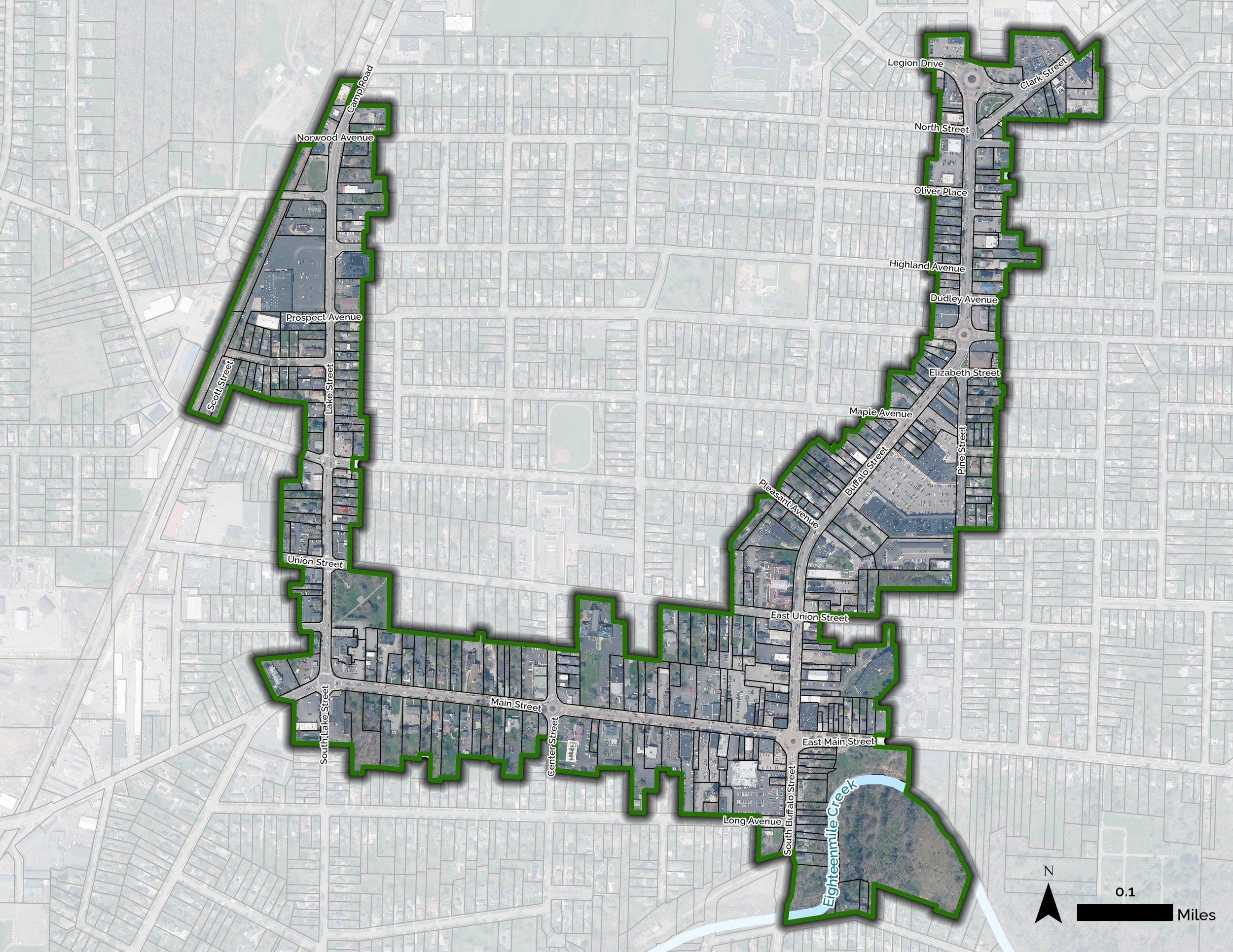
The Hamburg NY Forward Area encompasses the heart of the Village of Hamburg’s historic central business district, extending primarily along Lake Street, Main Street, and Buffalo Street. The boundary captures a concentrated mix of commercial, civic, recreational, and cultural assets, including locally owned businesses, mixed-use properties, public parks, and community gathering spaces that contribute to the Village’s identity and support daily community life.
Spanning approximately 168 acres and encompassing roughly 353 parcels, the area follows Lake Street for approximately 0.68 miles, Main Street for 0.58 miles, and Buffalo Street for 0.90 miles. The area includes all of the Village’s Central Business and Mixed-Use zoning districts, creating a connected commercial and mixed-use core that serves residents, businesses, and visitors.
Major community assets within the area include Centennial Gardens Park and Eighteenmile Creek, as well as Memorial Park. Together, these commercial, civic, recreational, and natural resources reflect the Village of Hamburg’s longstanding role as a vibrant community and service center within the greater Southtowns region.
Stay Updated
Sign up for email updates.